The dirt on Depave Chicago
What, Why, and Where to Depave Chicago
What is Depave Chicago?
Depave Chicago is an initiative to transform paved land to healthy, life-supportive spaces and to do this by working with communities hand-in hand who envision and desire to enact a better future. Depave Chicago emerges from years of research and critical analysis about the impacts of pavement on communities and natural systems—impacts that are both visible and invisible in our air, soil, water, and human bodies.
As an organization, Depave Chicago hopes to create a sustaining coalition of individuals, organizations, and institutions to work together to address pavement in the city, site by site and across the region. Our goal is to undertake projects that speak to the unique needs of each site, and over time, to build the physical and social tools needed to scale projects and capacity with more communities over time.
Depave Chicago participates and is learning from a growing movement across the North America to bring awareness to the legacy problems of our overlay paved city and to create tools of collaboration to transform paved sites through landscape design.
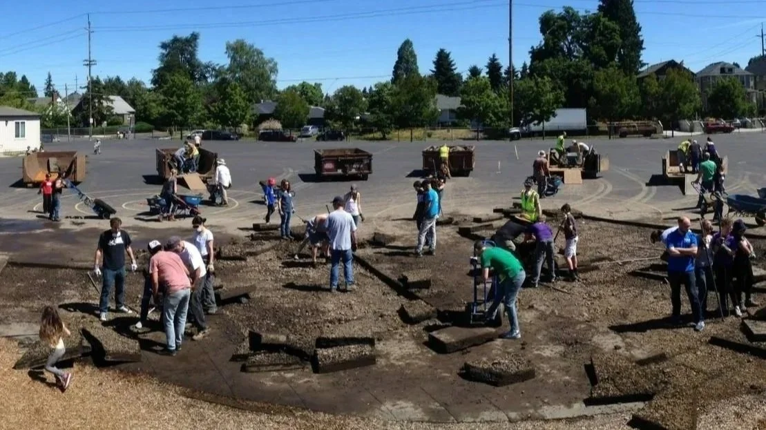
Removing pavement! Image courtesy of Depave www.depave.org/astor/
Why Depave Chicago?
Over the last century pavement has come to dominate cities so much so that we’ve become numb to its presence. Yet high concentrations of pavement pollute waterways through converging stormwater run-off, creating eddies of residential flooding, and intensifying the urban heat island effect. Excess pavement leaves cities and communities vulnerable in the face of climate change and creates risk and liability for future investment into the city.
On average, 35% of Chicago’s urban land is paved and approximately 90% of that pavement is asphalt. Some parts of the city including community areas are constituted by even higher percentages of pavement. For example, the community of McKinley Park, where MAT Asphalt operates one of its asphalt production plants, is 46% paved. East Garfield Park is 41%. South Lawndale encompassing Little Village is at 43%. Brighton Park has 46%. These percentages are staggering and speak to a city and communities in peril as we face climate change and increasing heat.
Embracing depaving is a critical step forward to achieving the City’s climate adaptation plan, tree canopy targets, green and complete streets policies, green stormwater infrastructure with volume control targets, and equitable public space. A key solution lies in the problem of pavement.
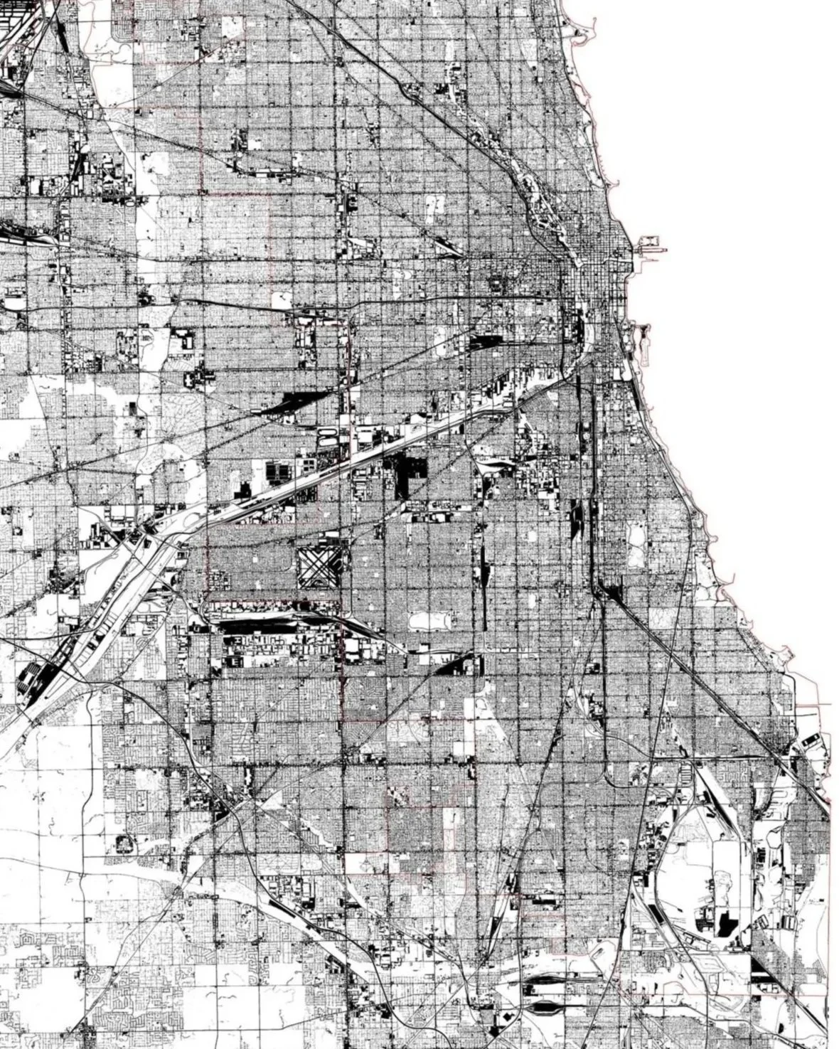
Sample of pavement map of Chicago and Cook County. 35% of the land cover across the City of Chicago pavement.
Source: Landcover data set 2018, provided by The Morton Arboretum, prepared by The Morton Arboretum, USDA Forest Service, and The University of Vermont
Where to Depave Chicago?
Depaving places like underutilized and unused parking lots, school playgrounds, abandoned vacant land, as well as street parking lanes is key to this process.
Parking lots and paved areas exist in all shapes and sizes throughout the Chicago region. Large paved areas are concentrated around waterways, industrial, and commercial sites, while smaller paved areas exist in school grounds and church parking lots. All of these are important sites for depaving—creating green where there’s gray—where children play, people breathe, families and friends gather, where tree roots seek growth and nourishment, rainwater touches and mingles with earth, and where animals, insects, and birds flourish.
Depave Chicago will work with communities and cities to explore new uses for proposed sites that meet its vision and goals. No site is too small to make an impact. We welcome communities to contact us with proposed project locations.
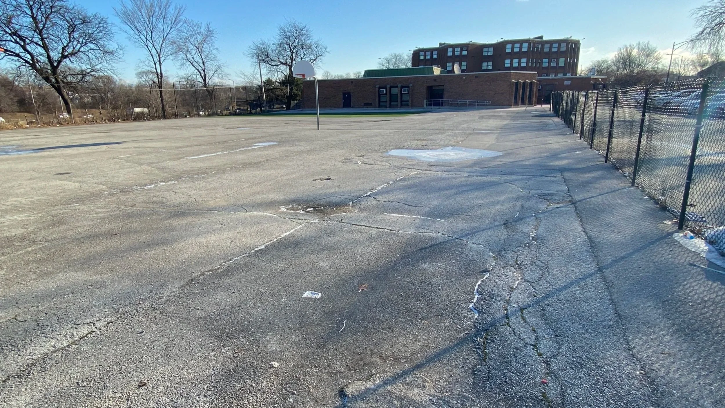
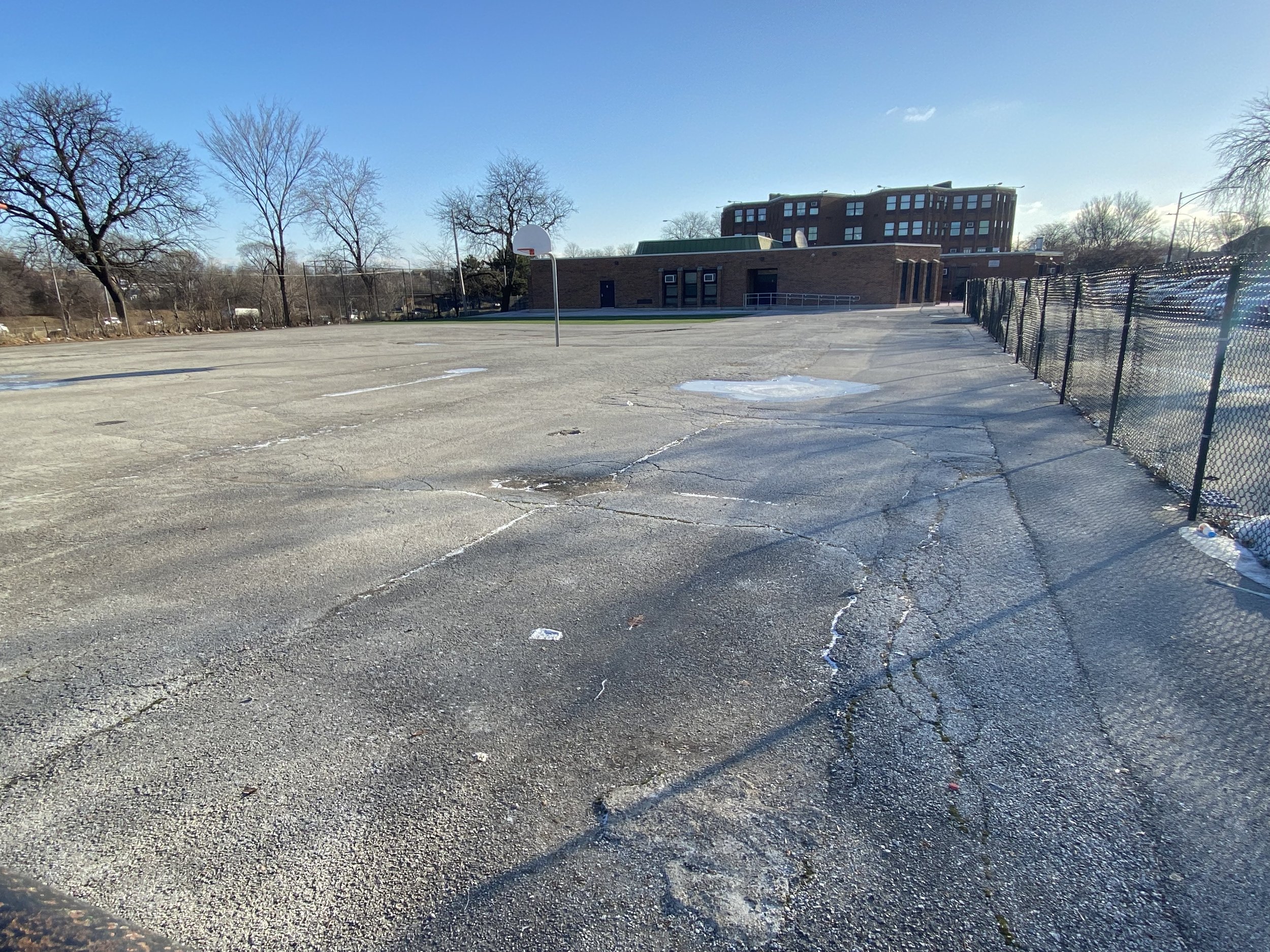
An example of a paved school playground in Chicago.
Photo: Mary Pat McGuire